Genesis 13 (WEB)
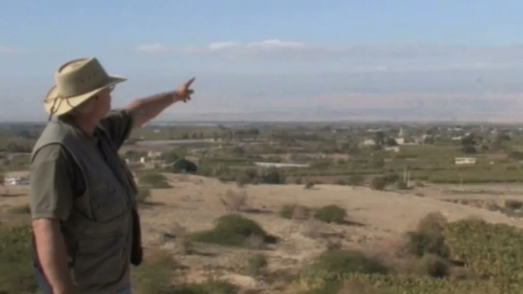
Dr. Steve Collins explains to Dr. House why he believes Tall el-Hammam is ancient Sodom rather than Bab edh-Dhra south of the Dead Sea.
I'm eager to hear all you have to say about ancient Sodom here.
It's my pleasure today to introduce to you Dr. Steve Collins, the Dean of the College of Archaeology at Trinity Southwest University.
And he's here with me at the place that he is in charge of an excavation, Tall el-Hammam, in Jordan near the Dead Sea.
And what he views to be ancient Sodom, and there's so many interesting arguments for that position, in contrast to a more traditional view that has been argued by some at the southern portion of the Dead Sea.
So what we're going to have him do is basically go through the explanation of how he came to view this site as being ancient Sodom, the argumentation for that being the case,
sort of to contrast that with what people are saying about the Sodom, some identify the southern portion of the Dead Sea, and we'll get an entire perspective on that for you.
And I'm just really pleased to shake hands with Dr. Collins, and I'm so thankful to be a part of the excavation here for these few days.
Thanks for being here, Wayne.
Well, what I'd like to show you is the essence of the biblical geography that is specifically written in Genesis 13, chapter 13 verses 1 through 12, to take us to the city of Sodom.
The Bible is what I call a serial geography.
That is mostly in the Old Testament.
The writers are taking us from place to place to place, and actually nobody speaks and no events occur without being tied to a specific location.
So location is so very important.
Now, there is a specific passage in the Old Testament, and just one passage, and that's Genesis 13, that was specifically written in order to take us to the location of the cities of the plain and to the place we call Sodom.
Now, the essence of that is understanding what the known geographical quantities are, and we can work from the known to the unknown in a quite easy fashion.
So let's lay out the story, and then we'll come back and point by point deal with the geography.
The story goes that Abram, in chapter 12, had come into the land of Canaan from the north.
He had come down from Haran and pitched his tent, it says, with Bethel on the west and a place called Ai, or Ha'ai, some say Ai, on the east.
And the location of those two sites is directly… almost directly west of us, on the highest hills of the central highlands of Canaan, and ten miles north of Jerusalem.
Jerusalem is right behind him, directly behind me.
And right to my left here behind is Jericho, at the same level, right across the river, same distance from the river on the other side that we're standing on this side,
and there's Jericho.
So if you go up from Jericho to the very highest point west northwest of Jericho, you come to Bethel and Ai.
So there's our first known quantity geographically.
Now from Bethel and Ai, in chapter 13, it says that Abram from this area had gone into the Negev, and he had worked his way down, and Lot and Abram are in the Negev.
And it says they came from the Negev, moving from place to place.
It actually says place to place.
There's that serial geography.
Moving from place to place, that is, camp to camp.
They're nomads.
They're pitching their tents.
They stay in one location until they pull up their tent pegs and move to another location, and thus the story follows the geography.
We're moving then from place to place, from the Negev.
They came back northward.
So, we find at the beginning of Genesis 13 that Abram and Lot have taken their tents from the Negev and parked them in the area of Bethel and Ai.
Now, by the way, we used to excavate there, and so we took many pictures from there.
You could actually see the place we're standing now from there.
And so back and forth, there is a very easy line of sight contact between the two locations.
So they're quite close together.
We are only actually about 25 kilometers from the other side of the foothills.
The foothills on the other side to the foothills on this side, about 25 kilometers, so quite close.
Now, from Bethel and Ai, something very important happens geographically in the story.
And what I found that many scholars who were looking for Sodom failed to do was to ask the question, where was Lot standing when he lifted up his eyes and saw the plain of the Jordan and the cities upon it?
Where was he standing?
Well, in fact, it says that they were camped and herding their sheep and flocks around Bethel and Ai.
So the answer to the question is where was Lot standing when he lifted up his eyes, is that he was at Bethel and Ai.
So he's in the area of Bethel and Ai, and he looks over, and it says he could see the entire plain of the Jordan.
Now, why was he looking in the first place?
Because remember, Abram and Lot had decided they had too many clans, too many herds in order to camp in one location.
So from that location, they said, well, Abraham says, you go to the left, I'll go to the right.
You go to the right, I'll go to the left.
Lot says, okay.
And so Lot then gets to pick his direction.
And so from that location, Lot begins to scout out where he might like to settle.
And he really actually respects Abram's sort of established position in Canaan, and decides to move beyond that location out of what would be normally Abram's range of nomadism.
And so it says he looks from Bethel and Ai, and he sees that the entire circle of the Jordan is well watered.
Now the word there is sometimes translated plain, that he could see the entire plain of the Jordan.
But the word is the Hebrew term kikar.
Now kikar means… all through the Old Testament, it means either a talent of silver or gold, a flat circular disc or ring of metal, or it means a flat circular loaf of bread, like a pita bread or a tortilla.
And so it means a flat circular disc, either of metal or of bread.
And so what we're talking about here is not a geographical term at all.
It's sort of like in New Mexico, we call flat-topped hills mesas.
Yeah, because that's the Spanish word for table.
Table is not a geographical term, but sometimes we use it because something looks geologically like a table.
So why did they call this the Kikar?
They called it the Kikar because the Jordan Valley comes down with hills on each side, very narrow, until you get about 25 kilometers north of the Dead Sea.
Then the hills go out dramatically and form a circular alluvial plain, and they come, the hills come back together at the north of the Dead Sea, right here, you can see them.
And so what this whole thing looks like, really, I always describe it as sort of a boa constrictor that swallowed a cow.
And so you have this long slender valley and this big bulge in the middle, which is this big circular alluvial plain, very excellent agricultural area.
And it is called in the Bible, in this passage, the kikar, the flat disk, the circle of the Jordan.
It may also be a reference to the bread that is produced here.
This is a bread basket and a very wealthy place, thus the reference to possibly the talent.
The talent or the bread, it's a very wealthy area, the Kikar of the Jordan.
Now, the next geographical quantity that we have to deal with is the Jordan itself.
Hayarden actually means the descent.
Now, the descent of what?
Well, water, fresh water.
Now, the Bible in five different passages, if you collate those five passages together from, say, Joshua to Deuteronomy, it describes very clearly what constitutes Hayarden, the Jordan.
It says that it comes from the melting snows of Mount Hermon down to the Sea of Kinneret, to the Sea of Galilee.
It then descends, that's the word Hayarden, it then descends through the Jordan Valley.
And it says it ends at the Bay of the Dead Sea, right here, at the Bay of the Dead Sea, at the mouth of the Jordan, below Pisgah.
Now, where is Pisgah?
Well, Wayne, it's right behind you.
That's Pisgah, Mount Nebo, Mount Pisgah, where Moses stood and looked over into the Promised Land.
Now, what's interesting about that is that Pisgah is parallel with the north end of the Dead Sea on an east-west axis.
So there is Pisgah.
The north end is an exact geographical point reference that marks the southern end of Hayarden, the descent of the Jordan.
Yes, it's going down.
And the descent means it goes down to the place where it can no longer descend.
The Dead Sea is the lowest spot on the face of the earth.
There is no lower place for the water to go.
That's the end of it.
So the Hayarden is the living water.
It lives until it ends at its mouth.
And at its mouth, it disgorges into the…
It literally dies at the Dead Sea.
And that's as low as it can go.
So the descent, the Hayarden, terminates at the Dead Sea.
Now, Scripture is very clear about that.
And because it's very clear about that, anytime we say the Kikar of the Jordan, it can only refer to the area, the circular area north of the Dead Sea, because the Jordan does not extend beyond the north into the Dead Sea.
So therefore, locating Sodom and the cities of the Kikar of Hayarden toward the south into the Dead Sea would be, biblically speaking, a geographical incongruity.
I think it's a geographical impossibility.
It just doesn't work.
Now, the fact is also that the Bible says clearly in Genesis 13 that Lot could see all of the Kikar of the Jordan from Bethel and Ai.
Now, if you go to Bethel and Ai, and by the way, it's about the same view as here, you can see the north end of the Dead Sea,
just a bit of it, as we see here.
You cannot see anywhere close to even halfway down the Dead Sea, much less to the southern end.
So that invalidates the southern end.
Right.
So unless Lot was having dreams and visions of something else, or a big telescope.
No, actually with a telescope you couldn't see, because the hills would block your way.
So it'd be very difficult.
So now here's the next part of the equation.
Lot is there, and it says he can see all of what we're looking at here.
And then it says, then he traveled eastward and pitched his tent as far as Sodom.
Now, if Lot is there, eastward is here.
It doesn't say he went east, crossed the river and then went 60 kilometers south.
No, it says he crossed and he came as far as Sodom.
So the geography is very simple.
By the way, it's a pretty small stage.
We can see everything in the story from here.
So he's at Bethel and Ai, he crosses and comes as far as Sodom.
Now, before that, it says that he sees the Kikar of the Jordan and it's well watered.
How well watered is it?
Well, it says it's watered like the Garden of Eden or the Garden of God, the Garden of Yahweh.
And how was Eden watered?
Well, a river ran through it.
Well, just not so coincidentally, we have the biggest river in the southern Levant running right through.
The Jordan is running right through the Kikar.
It splits it right down the middle into two semicircular halves.
So the Kikar is split by the Jordan River, just like Eden was split by its river.
Then it says it was watered like Egypt.
Now today, the Jordan River is a little creek, almost.
You could pole vault across it.
But in antiquity, without the siphoning off of all this water for agriculture, when it ran full before it had been obstructed by modern hydrology, the river was very large, probably was a quarter kilometer wide at all times.
And then the channel in the springtime would widen to several kilometers as it backed up against the Dead Sea with the overflowing of its banks.
Now, this is exactly what happened in Egypt.
It says it was that the Kikar of the Jordan was watered like Egypt.
How was Egypt watered?
The Nile ran through it, but in its delta, it overflowed its banks annually, and they would plant behind the receding waters in the newly deposited silt, and that drove the economy of Egypt to be very prominent and wealthy.
Well, the Nile hydrology is repeated here in miniature.
The Jordan hydrological system is exactly like the Nile, because every year it swells over its banks and floods quite prominently into the surrounding terrain, the flat terrain of its delta,
and they plant in antiquity behind the receding waters.
It is a Nile in miniature.
Isn't it interesting that who's collating this story together?
Moses.
He's sitting up there on Mount Pisgah, or here, looking at all of this going, oh, I grew up in Egypt.
This looks just like Egypt.
He would understand how this works.
And so this would not be lost on someone like Moses.
So the water comes down, it overflows, and thus the Bible says that this Kikar the Jordan, where the cities of the Kikar are located, is well watered like the Garden of God and like Egypt.
There's nothing like this in the south.
This is the perfect description, or shall we say the biblical description, is the precise description of what's happening here.
Now, as we said, Lot comes from Bethel-Ai across this kikar, this disk.
He comes as far as Sodom.
Now, there's a couple of other little geographical indicators that we need to look at.
Sodom is always listed as the first city in the list.
Sodom, Gomorrah, Admah, Zeboim.
Now, in Egypt, and we obviously have a little Egyptian influence in the text, in Egypt, on the Transjordan side of this area, on this side, the east side of the Jordan, in the Egyptian map lists,
the cities on this side of the river are always listed in south to north order.
If that follows for this passage, then we might surmise that Sodom is the southernmost.
Gomorrah, you go to the north and find Gomorrah.
You go up, that's the first doublet.
You go a little further north and find the second biggest city, Admah, and its doublet city or two, Zeboim is plural, and find those together.
And so Sodom, Gomorrah, Admah, Zeboim, with Sodom being the most southern.
Now, Sodom is also probably the largest of them.
And we see this in the fact that Sodom is always listed first.
It's always first in the list, never second or third.
Always first.
It's the only one ever mentioned alone.
Sodom often appears in the story singularly.
And the king of Sodom, King Bera, is the only one in the story who has a voice.
He speaks, he interacts with Abram, and so he's sort of the spokesman for this group of kings that are described in the next chapter, in chapter 14.
So it's always listed first, it's the southernmost one, and it's the largest of all.
And so if Sodom, so if we put all that together, the Bible suggests strongly that Sodom is the largest Bronze Age city on the eastern Jordan disk,
opposite what is traditionally Canaan on the other side of the river.
Now, the question is, if you were going to find it, you'd probably want to look for the largest Bronze Age city.
Now, by Bronze Age, we mean the Middle Bronze Age, which is the time of Abram.
Every scholar recognizes, whether you take early dates or late dates for the Exodus or wherever you put it, that Abram belongs to the Middle Bronze Age.
And so we would look for a large city that was Middle Bronze Age, but not just Middle Bronze Age, because Sodom is mentioned as one of the great cities of Genesis chapter 10.
The table of nations includes Sodom, Gomorrah, Admah, and Zeboim.
And so this would put us back into the time of urbanization before Abram.
We know exactly when that is.
It's Early Bronze two, three.
So we have to go back to the Early Bronze Age.
So if we're looking for Sodom and Gomorrah, we would certainly want to look for a city that's in the right place, that's visible from Bethel and Ai and east of Bethel and Ai and in the Kikar of the Jordan, north of the Dead Sea.
And in the right timeframe, it would have to have the Early Bronze Age and the Middle Bronze Age and probably everything in between.
And then it would need to be the largest such place.
Now, the largest such place in that location is here, we're standing on it.
Tall el-Hammam is about 40 hectares.
We're looking at it.
We can see the brown in the distance, the large lower tall that expands out.
In fact, the eastern tower is about 700 meters from where we're standing.
The other side of the city is about 400 meters from where we're standing.
So we have a huge city that spans a kilometer from east to west.
And nearly a kilometer from north to south, so it's one of the larger Bronze Age cities in the southern Levant.
It may be Hazor was a little bigger, but Hammam certainly would run a close second.
It's a very, very large city, but it's not just a city.
It has many satellites.
Now, how much bigger is Hammam, Tall el-Hammam, Sodom, than the other cities that we would be familiar with in the area?
It's 10 to 12 times bigger than Jericho in the same period.
It's 10 to 12 times bigger than Bronze Age of Jerusalem.
It's much larger than all the other satellites that we see around it.
Iktanu and Tell Ramah and Tell Kafrein off in this direction.
Tell Tahunah there, Tell Barakat.
So there are many, many cities in the area.
We can talk about Moes and Azamah and many, many others.
This is not just a city, it's a city state.
And this formulaic geography, Sodom, Gomorrah, Admah, Zeboim, is probably a description of that city state.
In fact, in Genesis 19, it is called Eretz HaKikar, the land of a particular, probably ethno-linguistic people who lived here in the land of the disk.
So these are all very important points, and it was very easy, in fact, when we first did our research, looking at the right place, the right time,
biblically, and determining what the right stuff is.
So we've got right place, right time.
What's the right stuff?
The Bible says that Sodom, that Lot sat in the gateway of Sodom.
It means it's fortified.
Well, so you can't just have any old site.
You have to have fortification.
Well, this whole site is massively fortified from the Early Bronze Age all the way to its destruction in the Middle Bronze Age.
Now, the other right stuff would be that the Bible suggests that when it came to its termination in the time of Abraham, that nobody lived there afterwards for a long, long time.
Now, Moses came to this same area, pitching his tents across from Jericho.
And the Bible suggests nobody's home.
He fights his way up, all the Edomites and Ammonites, Moabites and Ammonites and Og's kingdom and all that.
But when he comes down to the plains of Moab, it seems to be sort of a restful place because nobody's home.
So in the time of Abraham and Lot, it's a well-watered plain of the Jordan with many cities, a whole civilization, highly populated.
In the time of Moses, it's called the wasteland below Pisgah.
So how did it get from well-watered agricultural plain to wasteland?
We know that story in Genesis 19.
Now, for the dates of this city, it dates all the way back to the Chalcolithic period.
It goes all the way back before there were walled cities.
It grew into a walled city in the Early Bronze Age, beginning sometime around 3000 BC.
And then it continues on without break.
There's no break in occupation here.
It was never destroyed successfully militarily.
We do have a few earthquake shakes evident in the archaeology.
But for the most part, we can go from the Chalcolithic period to the destruction in the Middle Bronze Age in a meter and a half.
And then nobody lived there in this area, not just this city, but in all the other, in all this whole area.
Every town and village and city in this area was destroyed simultaneously at the end of the Middle Bronze Age.
And no one lived in this entire well-watered plain for the next 700 years.
That's very hard to explain why people would not live here and rebuild cities, especially the Caesar.
These are crossroad trade route cities.
And why wouldn't they be rebuilt?
Something must have happened that literally frightened these people away.
Anybody living in the region frightened them.
The stories, the lore that came about as a result of this calamitous event that occurred, the Bible describes it as fire and lightning from the sky descending and destroying an entire civilization.
And if that really occurred, which it's pretty obvious from the archaeology that something like that actually did occur, that that would frighten the local inhabitants to the point where perhaps they would not even want to hardly even cross this area for a long, long time.
Yeah, so we are finding a lot of indicators of destruction at the site.
Here we have a massive layer of ash covers the lower tall.
It covers the upper tall, has a little Iron Age city built on top, but you dig under that, you find that same ash layer from the Middle Bronze Age.
We're finding lots of high heat type indicators in some melting of some surfaces of pottery, even sand.
At distances from the site, we find what's called desert glass.
The glass that has been, sand that's been heated to such a high temperature that it melts.
And so there are all these kinds of little, little indicators, little tantalizing clues that something here occurred that was so dramatic, so powerful that it literally singed the minds of people in antiquity and forged the story of the destruction of Sodom and Gomorrah.
Of course, the biblical text gives us the sort of the divine perspective on what the truth was about all of that.
But the fact is that the archaeology of the area specifically not only confirms that the largest city on the eastern Jordan disk actually does exist here, but that it was destroyed at the right time,
according to the biblical text.
And that no one actually lived here.
So there was nobody home.
From an archaeological point of view, there's nobody home here in the time of Moses.
So Moses came here, set up the tent.
Yep.
It's interesting that it would be just like God to come here and put his presence, the tabernacle, the Ark of the Covenant, right on ground zero of the lower tall, which is, as you can see,
a nice circular disk, flat place where they could camp, and Moses could put his camp up here at Abel Shittim.
Now, most scholars already agree that that's what this is.
It's Abel Shittim.
And so here we have Moses' encampment, and there we have the tabernacle and the Ark of the Covenant and all the Israelites round about.
And what's interesting is that right under that area, if they would have placed the tabernacle on the geographic center of the lower tall, it means that it's sitting right on the temple precinct from Sodom.
So we have the pagan worship center, Canaanite worship center of Sodom sitting right there, but yet God parks His most holy object, the Ark of the Covenant, right there.
Yeah, but it's sort of like God's way of saying, okay, let's cleanse it.
Let's bring about, let's bring my grace to bear on this place.
And of course, we could go even further into Ezekiel 16 and talk about God's promise to restore the fortunes of Sodom along with Jerusalem.
So we could say it ain't over yet with respect to Sodom.
Nebo is where you see the building on the very… highest hill.
See the buildings and the trees.
That's Mount Nebo.
And was buried up there.
Yeah.
So the geography is pretty incredible from here.
Of course, we can see Jerusalem on the hill.
We can even see the Herodium just a little bit to the left.
And of course, that's the area of Bethlehem.
Hebron's just a little bit further down the row.
And we have Mount Nebo here, Dead Sea, Jordan River, Jericho across the river, Gomorrah, which I think is this tell sitting right off to here.
The new publication on Tell Kafrein shows that it was originally built in the Early Bronze Age, destroyed in the Middle Bronze Age.
And nothing there in the Late Bronze Age.
Exactly the same profile as here.
So that's a very good candidate for a Gomorrah, because it's going north and right around the corner, Tell Nimrin, already been excavated, has exactly the same profile.
All of these have the same features.
Exactly.
And yet they're separated so far, so a major catastrophe.
They hit a large area.
I don't know what else you could ask for in finding the cities of the plain.
I really can't answer.
I get asked that question a lot.
I really don't know what the answer to the question is.
Now, if you go back to the 19th century, the 19th century explorer scholars like Wilson and Conder and Merrill and Thompson and a bunch of others, they spent a lot of time in this area riding around on horseback with their Bibles over their saddle horns, looking for biblical locations by following the geography of the text.
Every one of those men came to this site and stood.
In fact, Thompson camped with Tristram on top of this site.
And they looked around at these ruins and they said, and they saw the ruins there and there and the other places.
They said, which one of these is Sodom?
We don't know, but it must be here, because they followed the text.
They looked at Bethel and Ai.
They talked about the kikar.
They followed it and they wound up here.
But Thompson stood up here, missionary scholar.
He wrote four volumes of geography, massive volumes.
And so in those, in 1881, he writes that he stood here at Tall el-Hammam.
He mentions it by name.
He says, he asks, which of these is Sodom?
I don't know, but it must be one of these because this is where the Bible says it is.
So someday when, I'll say when I see W.M.
Thompson again or once more.
I'm not that old.
I haven't ever seen him.
When I see him again, or when I see him for the first time, I'll get to say, hey, buddy, you were right on.
Not only were you right, but you were standing on Sodom itself.
So the 19th century scholars put the cities of the plain here.
In fact, if you look at their Bible maps from the 19th century, this is where they were.
Interesting, how did then we get this southern view?
How did that evolve?
Well, the main culprit is W.F.
Albright.
Because Albright seems not to have read any of those other guys.
He only read Edward Robinson, Robinson of Robinson's arch fame in Jerusalem.
Robinson spent a couple of months in this area.
Of course, Thompson spent 40 years.
So Robinson comes over here and spends a few months and goes back to the United States and writes up his memoirs of the area, talks about Sodom and Gomorrah being in the south.
Well, I can understand why people would think that, not from a biblical point of view because it's impossible to go south biblically, but if you go down there sort of etiologically,
the southern of the Dead Sea looks like a place God would have destroyed.
And there are some cities down there.
But the problem is, number one, they're in the wrong place.
Number two, they're in the wrong time period.
Albright knew that Bab-edh-Dhra, Numeira, all the traditional sites of Sodom and Gomorrah were all destroyed about 2400, 2350 B.C., hundreds of years before Abraham was ever born.
And so even using the earliest possible chronology for Abraham, those cities were gone by then.
1Abram went up out of Egypt—he, his wife, all that he had, and Lot with him—into the South. 2Abram was very rich in livestock, in silver, and in gold. 3He went on his journeys from the South as far as Bethel, to the place where his tent had been at the beginning, between Bethel and Ai, 4to the place of the altar, which he had made there at the first. There Abram called on Yahweh’s name. 5Lot also, who went with Abram, had flocks, herds, and tents. 6The land was not able to bear them, that they might live together; for their possessions were so great that they couldn’t live together. 7There was strife between the herdsmen of Abram’s livestock and the herdsmen of Lot’s livestock. The Canaanites and the Perizzites lived in the land at that time. 8Abram said to Lot, “Please, let there be no strife between you and me, and between your herdsmen and my herdsmen; for we are relatives. 9Isn’t the whole land before you? Please separate yourself from me. If you go to the left hand, then I will go to the right. Or if you go to the right hand, then I will go to the left.”
10Lot lifted up his eyes, and saw all the plain of the Jordan, that it was well-watered everywhere, before Yahweh destroyed Sodom and Gomorrah, like the garden of Yahweh, like the land of Egypt, as you go to Zoar. 11So Lot chose the Plain of the Jordan for himself. Lot traveled east, and they separated themselves from one another. 12Abram lived in the land of Canaan, and Lot lived in the cities of the plain, and moved his tent as far as Sodom. 13Now the men of Sodom were exceedingly wicked and sinners against Yahweh.
14Yahweh said to Abram, after Lot was separated from him, “Now, lift up your eyes, and look from the place where you are, northward and southward and eastward and westward, 15for I will give all the land which you see to you and to your offspring forever. 16I will make your offspring as the dust of the earth, so that if a man can count the dust of the earth, then your offspring may also be counted. 17Arise, walk through the land in its length and in its width; for I will give it to you.”
18Abram moved his tent, and came and lived by the oaks of Mamre, which are in Hebron, and built an altar there to Yahweh.